‘We got lucky:’ Brunt of Tuesday storms missed Portage County, officials say
By Brandi Makuski
Some temporary road closures and down trees aside, Portage Co. missed the worst of last night’s line of severe thunderstorms.

A long line of several storms impacted Marathon Co. far worse, Portage Co. Sheriff Mike Lukas said.
“We had minimal trees down, minimal power outages, no additional problems reported to us,” Lukas said Wednesday morning. “But that’s the extent of it, everything went north or south of us.”
The county’s emergency operations center (EOC), which serves as a communications hub to marshal resources during emergencies, opened in the basement of the Law Enforcement Center from 4-9:30 p.m., Lukas said. Inside were Bob Weinert, the county’s emergency manager, his deputy, Bonnie Skalecke, and a local ham radio group member, monitoring weather conditions, testing readiness, and taking reports from weather spotters.
It was a “soft open,” Lukas said, meaning that most department heads weren’t present but on-call in case the situation worsened and they needed to respond.
Highway Commissioner Nathan Check said no major infrastructure damage was reported to his office. But his department has received multiple calls about down trees across the county, one that resulted in road blockage but it was quickly removed.
“We’ve got multiple crews out now doing cleanup, debris on the side of the road, that kind of stuff,” Check said Wednesday morning, adding that two of his department’s chippers were on loan to Marathon Co., where damage was far more extensive.
In Stevens Point, Police Chief Bob Kussow said a few down trees and flooding were reported to the SPPD.
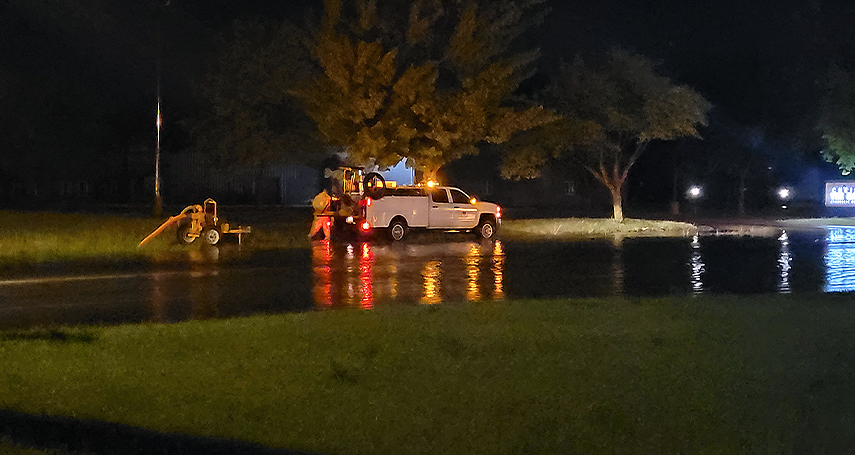
Flooding at the underpasses of Church St. and Michigan Ave., a seasonal commonality, triggered road closures at about 8 p.m. on Tuesday, Kussow said.
Flooding on city roads also prompted closures, most notably on Industrial Park Dr., River View Ave./Nebel St., and the 2600 block of Water St.
Attempts to reach Utilities Director Joel Lemke and Scott Beduhn, director of public works, for additional information were not successful on Wednesday morning. But Parks Director Dan Kremer said city parks saw “very minimal damage.”
“[We saw] mostly blown over garbage receptacles and some smaller-sized branches for pick up today,” Kremer said by email Wednesday morning.
A portion of the roadway was temporarily blocked when a tree fell into the roadway on the 1300 block of West River Dr., but it was quickly removed, Kremer said.
Plover saw similar impacts. Police Chief Ryan Fox said no major damage was reported to village police.
Roy Hopfensperger, public works manager, said one down tree blocking both lanes was reported at Beechwood Dr. and White Pine Dr., but the tree fell after the storm had passed.
The tree may have been damaged during the storm, Hopfensperger said, but the blocked road was reported early Wednesday morning. Crews were dispatched quickly to remove it, he added.
“We had a couple of small washouts near our roads because of the heavy rain, but nothing major,” he added.
Fire Chief Victor Voss in Amherst and Stockton Fire Chief Jeremy Spencer said they were unaware of any major damage in their respective areas.
WPS power outages peaked at 177 customers last night, and about 359 Alliant customers lost power. Most of those outages have been resolved, although WPS is reporting about 50 customers are still without power on Wednesday morning.
The National Weather Service (NWS) warned Portage Co. of 70-mile-an-hour gusts and heavy rains with possible tornados on Tuesday night. While no tornados were confirmed, weather spotters reported cloud rotation near Bevent and Shantytown, but it’s unclear if a tornado touchdown has been confirmed.
According to WAOW meteorologist Justin Lowe, Plover wind gusts topped out at 36 miles an hour at 8:13 p.m., and the village recorded 2.30 inches of rain.
The NWS observation site in Stevens Point recorded a 40-mile-an-hour wind gust and 2.0 inches of rain.
By comparison, Lowe said, gusts were higher in Wisconsin Rapids, which saw a 63-mile-an-hour wind gust, and a 70-mile-an-hour gust was recorded at the Marshfield Municipal Airport.